
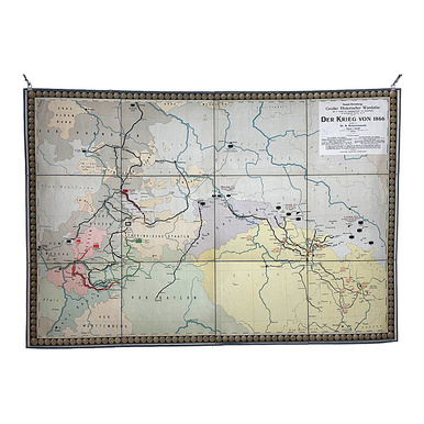
Wall atlas about the war of 1866
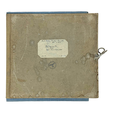
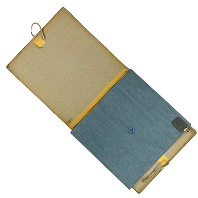
map composed of several parts, mounted on linen, inscribed in detail upper right "Haack-Hertzberg, Großer Historischer Wandatlas, Abt. V, Karten zur Kriegsgeschichte von Deutschland, a) Strategische Karten, Nr. 14", in a folder with handwriting, map on the back and folder with imperial eagle stamp, publisher Justus Perthes, Gotha, good age-appropriate condition, slight signs of use, overall dimensions 109.5 x 161.5 cm (HxW)
Lot
Limit:
Your maximum bid: €
by telephone
When bidding by telephone, you will automatically bid the limit or the registered pre-bid (telephone bidding is only possible from €100). Only when the limit/pre-bid has been reached we will call you to bid further on. Your telephone bid will be treated as a written bid up to the registered pre-bid and will of course only be used to the extent necessary.
If you save your absentee bids on the bid list, you will be able to change or delete them until you submit them. If you do not submit your absentee bids, they will not be considered. They must be submitted before the auction starts.
You can submit your absentee bids now using the "Submit absentee bids directly" button, or later using the "List of Bids" menu item.

